Hugh Mannity
Mediocre Member
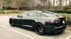
I thought the same thing, but did you mean "ass" because all of the shots showed the rear end of the Tesla S? ;-)
Both meanings
")


You can install our site as a web app on your iOS device by utilizing the Add to Home Screen feature in Safari. Please see this thread for more details on this.
Note: This feature may not be available in some browsers.
I thought the same thing, but did you mean "ass" because all of the shots showed the rear end of the Tesla S? ;-)
Don't lie, you went for the banana bread, not the scenery, right??? ;-)Kahakuloa, Maui, in the background.
Darn it. Now I'm going to have to go to Maui, so worth the drive. Even with all my screaming passengers who I make come along for the ride.Don't lie, you went for the banana bread, not the scenery, right??? ;-)
Don't lie, you went for the banana bread, not the scenery, right??? ;-)
@beeeerock, I actually skipped the banana bread stand because I was afraid to stop. Although they have now paved the parts of the western Maui loop that were gravel, it is still a very, very narrow road in many places. I was actually thinking of turning around (I came from the Kahului side and not the Lahaina side), but white knuckled it through. In 3 years of having my Model S on Maui, it is the first time I braved that stretch of road.
Is that the stretch of road past Hana to the west that loops around headed back north towards Kihei? I didn't know they had paved that! I drove that stretch several years ago when it was all gravel. It's very desolate on that side of the island but we were still able to spot a few whales just off the coast so I guess that made it worth it lol.@beeeerock, Although they have now paved the parts of the western Maui loop that were gravel, it is still a very, very narrow road in many places.
and my wallet lived to tell about it. I'm talking 1991.........long time agoThat's the one I was talking about. I of course was in a rental car too. Shhhhh... don't tell Thrifty
Not very exotic, I took this on the county road leading to my neighborhood shortly after I got my car, looking due south. @ThisIsTrue uses this road for access as well. It isn't flat here!