Nah, I'm a "poor" I drive the MSM 3Holy *sugar* that’s phenomenal news! We’re actually coming back through tonight and this would be a godsend. I think I saw your model S with the vanity plates in Ridgway yesterday?


Welcome to Tesla Motors Club
Discuss Tesla's Model S, Model 3, Model X, Model Y, Cybertruck, Roadster and More.
Register
Install the app
How to install the app on iOS
You can install our site as a web app on your iOS device by utilizing the Add to Home Screen feature in Safari. Please see this thread for more details on this.
Note: This feature may not be available in some browsers.
-
Want to remove ads? Register an account and login to see fewer ads, and become a Supporting Member to remove almost all ads.
You are using an out of date browser. It may not display this or other websites correctly.
You should upgrade or use an alternative browser.
You should upgrade or use an alternative browser.
Supercharger — Montrose, CO
- Thread starter dgpcolorado
- Start date
That might have been my S-60. I charge in Ridgway when I have reason to be down in town for awhile and did so yesterday afternoon. I've had the license plates for more than nine years now:...I think I saw your model S with the vanity plates in Ridgway yesterday?

From another thread in case you guys are curious:
"Montrose CO on 12/26/20.
Funny story: When we were a few minutes from the SC, I noticed it had been grayed out. We got there, it was coned off by a guy preparing to re-stripe the stalls. He had striped it earlier, then the build team came in and installed the pylons at a different spacing than the specification given to the striping guy, so he had to come back, paint the old lines black, and put down new ones."

mountainsean
Member
Yep that's the one! Thanks for all the updates over the last few days folks, we were able to Supercharge in Montrose yesterday and it was the difference between getting home last night vs. having to stay another night in a hotel.That might have been my S-60. I charge in Ridgway when I have reason to be down in town for awhile and did so yesterday afternoon. I've had the license plates for more than nine years now:
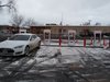
View attachment 622202
Looks like it, people are charging and it's showing in the app 4/8 in use, so it seems it's fine now. No guarantees for the future, but it's probably fineI’m curious is it’s open now (12/30) as I’ll be driving through there in a day or so. Thanks!
Thanks. Interesting, my app shows none available and none being used.Looks like it, people are charging and it's showing in the app 4/8 in use, so it seems it's fine now. No guarantees for the future, but it's probably fine
Yesterday Montrose was showing "reduced service". When I charged there all seemed normal. I spoke with a technician repairing a stall at Grand Junction and he said that he was scheduled to fix a stall at Montrose next week but that the station was otherwise operational. That turned out to be the case.
So, if you need Montrose and it shows reduced service, you should be ok.
So, if you need Montrose and it shows reduced service, you should be ok.
FrailBedazzled
Member
Thanks for the heads up. I’m on my way there right now heading to Durango, and was concerned when I saw the reduced service message, so it’s nice to be able to check here for the latest
For those traveling between Montrose and Poncha Springs via US-50 and Monarch Pass, be aware of a periodic road closure in Little Blue Creek Canyon (west of Blue Mesa Reservoir) due to rock scaling in a narrow part of the canyon:

The current (June 7) road closure schedule:
If you don't want to time your trip to weekends or the weekday time windows when the road is open (expect a long line of slow moving traffic even after the construction zone during the windows), you can avoid this road closure by diverting to CO-92 through Hotchkiss and Crawford. This detour is about 55 miles longer and the roads are relatively low speed in places, although scenic in spots.

The current (June 7) road closure schedule:
Estimated weekly traffic impacts through November 2022
Work Hours: Monday-Fridays 8 AM-5:30 PM
Nightwork: Monday-Thursday 7:30 PM-6:30 AM
Monday-Friday OPEN for single-lane, alternating traffic operations in the morning, midday, and evening during the following times:
- 6:30 – 8:30 AM (Mondays open to two-way traffic)
- 12:30 – 1:30 PM
- 5:30 – 7:30 PM
Full roadway closures all other times:
- 8:30 AM-12:30 PM
- 1:30-5:30 PM
- 7:30 PM-6:30 AM
Fully OPEN on the weekends to two-way traffic (5:30 PM Friday to 8:30 AM Monday)
Motorists should plan in advance, and expect long wait times during the queue for the Monday-Friday single-lane openings, alternating traffic operations in the morning, midday, and evening. And full roadway closures reduced speed limits and narrowed roads. Significant delays are anticipated. Restrictions for vehicles over 70 feet in length and 10 feet in width are in place through the project area.
Traffic schedule and timeline are subject to change.
If you don't want to time your trip to weekends or the weekday time windows when the road is open (expect a long line of slow moving traffic even after the construction zone during the windows), you can avoid this road closure by diverting to CO-92 through Hotchkiss and Crawford. This detour is about 55 miles longer and the roads are relatively low speed in places, although scenic in spots.
tharasix
Member
Ugh. This will almost certainly impact my road trip in August, unless I manage to thread one of those single-lane needles. Thanks for the heads up! Perhaps I should peruse DOT sites next month for construction notices in the states I'm driving through.
If you have a car with at least 200 RM of range I suggest charging extra and taking the longer detour. One disadvantage of weekend travel, especially when getting closer to the Front Range (Denver metro area) is that roads are more crowded. I prefer weekday travel between Poncha Springs and Denver/Colorado Springs.Ugh. This will almost certainly impact my road trip in August, unless I manage to thread one of those single-lane needles. Thanks for the heads up! Perhaps I should peruse DOT sites next month for construction notices in the states I'm driving through.
One caution: try to avoid travel at dusk and dawn between Gunnison and the base of Monarch Pass, due to the danger of deer. This is true for many of the secondary highways in the Colorado mountains. The problem isn't seeing the deer, it is being blinded by headlights of oncoming cars so that seeing deer on the road is impossible. Try to travel on two lane mountain roads during the daytime, if possible. Not that deer on the road is not a familiar problem to anyone from the Midwest — at least we have lots of pumas here to keep our deer population under control!
tharasix
Member
I appreciate that advice. I'll be spending a night in Gunnison as I'm heading east, and there's no way I can get my wife up early enough to be driving at dawn in August, so we should be good. And I'm driving one of the original run RWD Models 3, so my range shouldn't be an issue. The biggest problem for me is that I wanted to try to visit the south rim of the Black Canyon of the Gunnison on the way east, and now I'd have to backtrack to Montrose if I kept that plan. Hmm.If you have a car with at least 200 RM of range I suggest charging extra and taking the longer detour. One disadvantage of weekend travel, especially when getting closer to the Front Range (Denver metro area) is that roads are more crowded. I prefer weekday travel between Poncha Springs and Denver/Colorado Springs.
One caution: try to avoid travel at dusk and dawn between Gunnison and the base of Monarch Pass, due to the danger of deer. This is true for many of the secondary highways in the Colorado mountains. The problem isn't seeing the deer, it is being blinded by headlights of oncoming cars so that seeing deer on the road is impossible. Try to travel on two lane mountain roads during the daytime, if possible. Not that deer on the road is not a familiar problem to anyone from the Midwest — at least we have lots of pumas here to keep our deer population under control!
Gunnison has a pair of level 2 EVSEs at the municipal building that you can use for a few hours if you will be staying in the area overnight: 201 West Virginia Ave.I appreciate that advice. I'll be spending a night in Gunnison as I'm heading east, and there's no way I can get my wife up early enough to be driving at dawn in August, so we should be good. And I'm driving one of the original run RWD Models 3, so my range shouldn't be an issue. The biggest problem for me is that I wanted to try to visit the south rim of the Black Canyon of the Gunnison on the way east, and now I'd have to backtrack to Montrose if I kept that plan. Hmm.
You could backtrack to Montrose after visiting the South Rim of Black Canyon — it isn't very far (twenty miles from the Supercharger Station to the end of the road, High Point, and then the same back to Montrose). Or you could visit the North Rim of Black Canyon from Crawford. The road to and along the North Rim is gravel but the vistas are just as good and there are fewer visitors. The distance from CO-92 in Crawford to the end of the North Rim Road is about sixteen miles, nearly all unpaved.
Whichever option you choose, I think that visiting Black Canyon of the Gunnison National Park should be a high priority. The canyon is so deep (1800+ feet) and steep (less than a thousand feet across at the top at the narrows) that it is very difficult to photograph well. These are a few of my many attempts:


The rock scaling project on US 50 in Little Blue Creek Canyon was put on hold while I-70 was closed in Glenwood Canyon, to allow the highway to remain open. Even though I-70 is open again, US 50 also remains open "until further notice." I drove through the rock removal project earlier this month and the sheer scale of it — and the size of the rocks — was remarkable.
As always, check cotrip.org to get an update on the latest road conditions.
As always, check cotrip.org to get an update on the latest road conditions.
Whichever option you choose, I think that visiting Black Canyon of the Gunnison National Park should be a high priority. The canyon is so deep (1800+ feet) and steep (less than a thousand feet across at the top at the narrows) that it is very difficult to photograph well. These are a few of my many attempts:
Gneiss pics! (Geology joke, sorry I couldn't resist.) I hope to get there someday soon!
As it happens, I have a river cobble of gniess in my front door rock collection (from the Westcliffe area, not Black Canyon). Schist and pegmatite are the other major minerals that make up the Black Canyon walls. The combination of hard rocks and a big elevation drop caused the Gunnison River to carve the canyon that is so steep and deep.Gneiss pics! (Geology joke, sorry I couldn't resist.) I hope to get there someday soon!
The geology is interesting around here. Took a geology class taught by a local geologist couple many years ago and learned a lot about this area. Turns out that my house is built on a glacial moraine on top of a sedimentary mesa (capped by Dakota sandstone). I have a big rock outcrop, with several trees growing out of it, that is some sort of quartzite, which is not in keeping with the sedimentary mesa. Turns out that it is a huge glacial erratic.
Ouray is mix of rock types, ranging from a young thousand plus foot thick volcanic layer of tuff-brecia to sedimentary layers to exposed precambrian metamorphic base rocks.
tharasix
Member
Home | US 50 Little Blue Creek Improvements that you linked above says that US 50 will remain open to two way traffic until 8/31.
Similar threads
- Replies
- 11
- Views
- 5K
- Replies
- 7
- Views
- 4K
- Replies
- 11
- Views
- 2K