


Welcome to Tesla Motors Club
Discuss Tesla's Model S, Model 3, Model X, Model Y, Cybertruck, Roadster and More.
Register
Install the app
How to install the app on iOS
You can install our site as a web app on your iOS device by utilizing the Add to Home Screen feature in Safari. Please see this thread for more details on this.
Note: This feature may not be available in some browsers.
-
Want to remove ads? Register an account and login to see fewer ads, and become a Supporting Member to remove almost all ads.
You are using an out of date browser. It may not display this or other websites correctly.
You should upgrade or use an alternative browser.
You should upgrade or use an alternative browser.
Supercharger - Mammoth Lakes, CA (8 V2 stalls)
- Thread starter ecarfan
- Start date
-
- Tags
- California Supercharging USA
GRA
Member
Ah, but the proposed SC in Bishop would have served Mammoth from the south just as well, while also opening up the U.S. 6 route into Nevada. Lee Vining, Bishop and Lone Pine are all spaced about an hour apart at major junctions with recreation you need to drive to, while Mammoth is primarily a destination with the recreation right there (and L2s/HPWCs available), and easily reachable round trip in winter from either of the first two locations. So, while I have no problem with Mammoth having an SC, it definitely provides less total coverage than the other options. In addition, Bishop is less likely to have snow, so fewer issues with plowing and damage.As an avid skier this supercharger and dual motor version of Model S are the tipping points for me to consider a purchase. I admire the technology but find it hard to justify a $90,000 car for almost exclusively home use. Like many skiers I have a lead foot and can drive to Salt Lake in 9 hours, and don't want to add another ~3 hours to the trip. But Mammoth being 6 hours instead of 5, I can live with that.
The supercharger definitely needs to be at Mammoth, and I'm not surprised it's a higher priority than Lee Vining. The volume of SoCal-Mammoth traffic is far more than the traffic over Tioga Pass. As noted, even with an 80+% charge at Lone Pine, you're barely going to get to Mammoth, especially in the winter. The existing slower chargers in Mammoth are mostly limited to people staying at specific hotels and/or require reservations for a limited number of spaces. And you need to have a decent charge leaving Mammoth for Lone Pine if it's cold. <snip>
It's a 4,000 foot gain. Throw in winter temperatures, a loaded car and chronic wind, I'd want a rated mile reading close to 200 leaving Lone Pine.It's 100 miles. Why would you barely make it even with a 2,000 ft elevation gain?
That's another argument for Mammoth. If I leave Mammoth close to fully charged I could usually get home in the downhill direction with only one charge stop in Inyokern.I notice you didn't mention scenic Inyokern.
Topaz Lake is a plus for SoCal skiers too, makes Mammoth + Tahoe trips viable. Mammoth to Topaz crosses 3 mountain passes and goes through the super cold microclimate around Bridgeport, so I think it's desirable those SC's are that close.
- - - Updated - - -
Using the TeslaSuoperchargerRawData.xls spreadsheet downloaded from another thread on this site, Lone Pine to Mammoth with average winter temperatures would require 185 rated miles.
Ah, but from where I live, I should be able to reach Lone Pine on a single charge in an S-85, assuming reasonable conditions. 206 miles and a 2000 foot net elevation loss.I notice you didn't mention scenic Inyokern.")
Coming from coastal LA/OC is another matter, of course.
Thinking of doing a late spring trip from Monterey to Las Vegas via Folsom, South Lake Tahoe, Mammouth, Lone Pine, Furnace Creek, Pahrump and then Vegas. Just wondering the viability of that route given time of year (chance to cross Death Valley is just too tempting). Stretching would be from Lone Pine to Vegas. Google says 228 miles distance (via Pahrump).
Thinking of doing a late spring trip from Monterey to Las Vegas via Folsom, South Lake Tahoe, Mammouth, Lone Pine, Furnace Creek, Pahrump and then Vegas. Just wondering the viability of that route given time of year (chance to cross Death Valley is just too tempting). Stretching would be from Lone Pine to Vegas. Google says 228 miles distance (via Pahrump).
Ooh, that's tight, but doable. Evtripplanner says while the distance is indeed 228, the RM is less. Depends on how much weight you are carrying, and the temperature. AC does not use as much energy as heat. If you take it easy, you could make it using only about 200 RM. Going average speed, using AC, and carrying about 400 lbs, you need about 213 RM. If you get a range charge at Lone Pine, you should be fine, taking it easy and watching your range, getting more liberal as you get closer. The big issue here is that if you run out of range, you are in the middle of the f***ing desert. Carry extra water!!! There are 14-50's available in Pahrump, according to Plugshare. If you are planning on spending any time there, perhaps you can add a few miles.
emupilot
Active Member
Thinking of doing a late spring trip from Monterey to Las Vegas via Folsom, South Lake Tahoe, Mammouth, Lone Pine, Furnace Creek, Pahrump and then Vegas. Just wondering the viability of that route given time of year (chance to cross Death Valley is just too tempting). Stretching would be from Lone Pine to Vegas. Google says 228 miles distance (via Pahrump).
Depending on which way you leave Death Valley, you could stop at the Beatty NV supercharger which should be built by then.
I wouldn't recommend Lone Pine to Vegas without the Beatty supercharger. It's a very up-and-down route, about 7,000 climbing and 8,500 descending.
Looking at a broad radius from SoCal, that was an interesting route I've driven which didn't look viable in Model S. But the Beatty supercharger will fix that.
Looking at a broad radius from SoCal, that was an interesting route I've driven which didn't look viable in Model S. But the Beatty supercharger will fix that.
mspohr
Well-Known Member
I've done Lone Pine to Vegas via Beatty. Fine if you watch your speed.Thinking of doing a late spring trip from Monterey to Las Vegas via Folsom, South Lake Tahoe, Mammouth, Lone Pine, Furnace Creek, Pahrump and then Vegas. Just wondering the viability of that route given time of year (chance to cross Death Valley is just too tempting). Stretching would be from Lone Pine to Vegas. Google says 228 miles distance (via Pahrump).
I've done Lone Pine to Vegas via Pahrump in my 40K mile old S85 on a 98% charge. It was very tight, but there was a strong headwind through Death Valley. The climb over the mountains before entering Las Vegas reduced my remaining range to 5 miles, but once over that there's a good drop down to the north Vegas supercharger, where I arrived with 8 miles of range. I wouldn't recommend it unless the wind conditions are favorable.
Thanks for the input. Instead, I could swing up to Scotty's Castle for a luxurious night and charge at Furnace Creek, and then to Vegas via Pahrump. (crossing Belle Vista Rd for a real thrill)
Last edited:
mspohr
Well-Known Member
Furnace Creek Ranch has a 14-50 if you ask nicely for the maintenance man to direct you.Thanks for the input. Instead, I could swing up to Scotty's Castle for a luxurious night and charge at Furnace Creek, and then to Vegas via Pahrump. (crossing Belle Vista Rd for a real thrill)
billarnett
Member
billarnett
Member
Using EVTripPlanner.com to determine if it is possible to drive from Manteca to Mammoth in an S85, assuming 19" tires, cabin temp 72, external temp 72, speed multiplier 1.3, gives this result:
--------------------------
Distance 185.3 miles
Driving Time 3:14
Total Energy Used 74.3 kWh
248 RM
Average Efficiency 401 Wh/mile
Net Elevation Change 9013 feet
---------------------------------
It is possible. But that is in ideal weather and it's cutting it close.
I just drove my P85D from Manteca to Mammoth. After a 100% charge in Manteca and driving mostly only 5 mph over the limit I made it to Mammoth with 4% remaining. The car's nav insanely tried to route me thru Bakersfield and Lone Pine but I just ignored that. I was well,past Oakdale before it decided to route over Tioga Pass. And then it alternated between estimating that I wouldn't make it and that I would arrive with 1%. That's actually not too bad to be off by just a few percent. But it caused a lot of range anxiety for my passenger. I was confident that driving slowly for the last 30 miles on 395 would get us there ok. But that turned out not to be necessary. EVTripPlanner was spot on given a speed multiplier of 1.1. I think it would be even easier in the summer when there's so much traffic that normal speeds are impossible. But a supercharger in Lee Vining would sure be good.
Bet TSLA
Active Member
Anybody taken a look in the past week to see if they've started? If they're going to finish by the end of the year it has to be soon. And the crews at Truckee and Topaz Lake finished recently so they might be available.
brucet999
Active Member
Thanks for the input. Instead, I could swing up to Scotty's Castle for a luxurious night and charge at Furnace Creek, and then to Vegas via Pahrump. (crossing Belle Vista Rd for a real thrill)
You'll have to put that plan on hold for a while. Flash flood damage last week to Scotty's Castle and its access road has it closed for at least a couple of months.
Owner
Active Member
Never thought I'd hear news of this on TMC instead of the news. This was not covered at all in the papers up here in Northern California. At least in regards to Death Valley.
You'll have to put that plan on hold for a while. Flash flood damage last week to Scotty's Castle and its access road has it closed for at least a couple of months.
Mammoth just opened! Any update on this SC? I am heading up Dec. 23rd and could really use it. I have no local place to charge when up there. I may have to use the Westin or Village HPWC (with my slow single charger). If I have to do that, does anyone have the info on how I go about using one of those? Happy to pay or use their restaurant, whatever. I just don't want to stay with them, as I am already staying at a condo (sadly, with no garage or outlet access).
I skied Mammoth Nov. 11-12. I swung by the Park 'n Ride Thursday afternoon and there is zero evidence of any construction activity. I saw one Model S at the Lone Pine charger on the way home.
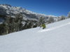
The season is starting on a promising note.


Sorry, I don't know how to delete the oversize images.
The season is starting on a promising note.
Sorry, I don't know how to delete the oversize images.
Attachments
Last edited:
Similar threads
- Replies
- 14
- Views
- 919
- Replies
- 6
- Views
- 931
- Replies
- 1
- Views
- 591
- Replies
- 74
- Views
- 14K