That test indicates nothing other than a system meant for fixed mounting doesn't handle non fixed mounting well.
Satellite tracking is primarily via the phased array beam steering, only gross pointing is done mechanically. Mechanical steering would drop the connection every time a sat goes out of field and it needed to reaquire.
An antenna system meant for static terrestrial use would not have the correct control loops nor IMU bandwidth (if it even has an accelerometer or gryo) for a dynamic situation.
Roughly, a 90 minute orbital period means 4 degrees per minute angular change for a satellite being tracked (really, it's faster, but I'm lazy). Rocking the vehicle is much more than that. (See also GPS receivers with static, vehicle, and plane modes). The base station beamwidth is only 1.5 degrees.
https://licensing.fcc.gov/myibfs/download.do?attachment_key=1190019
Note: file requires appending .pdf
During the drive, it appears the vehicle ended up pointing a different direction (shadow of head cast on passenger door). The software would not normally be set up to handle this situation, especially if it is using a magnetometer for azimuth and an accelerometer for elevation.
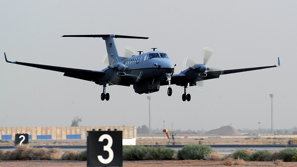
Starlink (properly configured) works with planes.
SpaceX's Starlink satellite internet was tested by the US Air Force and the results are in
A simple scan technique would allow reduced data rate functionality in dynamic situations with existing hardware, but that software would be a liability since the system should not be moving. In terms of emissions and safety, an induced movement should be flagged as a sensor error and result in termination of transmission until position and lock can be reestablished (or for x time, or until reset).