@drtimhill I want to take our discussion about Waymo's lidar to the Waymo thread.
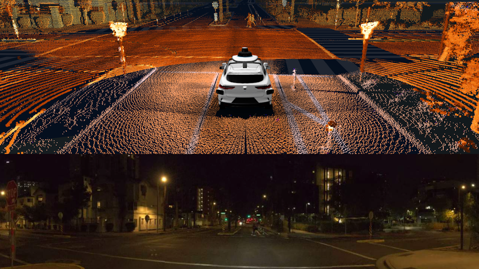
Just to give more detail from my previous post. In this image, the top view is the lidar point cloud with some color coding, the bottom view is the camera view. That is not the NN interpretation. That is the actual lidar point cloud you are seeing.
In the video, the top part is the lidar point cloud overlaid on the HD map with some UI added. The bottom part is the camera view. The vehicles, pedestrians are from the point cloud. It is not the NN interpretation. But that view does have some UI added, like the red wall to show where the car should stop or the line that shows the planning path.
As you can see from the point cloud, the lidar has high enough resolution to detect and classify objects. Of course, just like any sensor, lidar just provides data that software has to process. So it is the software that actually detects and classifies, not the lidar sensor itself. The same is true for cameras too. Cameras don't detect objects, they just provide data that software uses to detect objects. But the lidar provides enough raw data for the software to detect and classify objects.
The older lidar from a few years ago had lower resolution and was probably not as good at detecting and classifying objects. That is probably what you are thinking of. But the new Waymo lidar has much higher resolution as you can see from the image above. The new lidar definitely can detect and classify objects very well.
And check out this Waymo presentation where Anguelov talks about the new 5th Gen lidar and shows the lidar point cloud with color coding.
Hope that answers your questions.