EVNow
Well-Known Member
Yes - I'm talking about corporate appetite for risk taking ....My understanding is they have very little to do with each other, with minimal if any collaboration, which may be a good thing given the recent turn of events.


You can install our site as a web app on your iOS device by utilizing the Add to Home Screen feature in Safari. Please see this thread for more details on this.
Note: This feature may not be available in some browsers.
Yes - I'm talking about corporate appetite for risk taking ....My understanding is they have very little to do with each other, with minimal if any collaboration, which may be a good thing given the recent turn of events.
Well it has (sorta), The November event that was supposed to go in-depth on Ultra Cruise and include some Cruise announcements was cancelled. GM claims the cancellation was residue from the strike but really we know why.Is it delayed or has it come out ?
I wonder how the Cruise fiasco will affect Ultra Cruise ....
That move at 2 minutes was *impressive*.
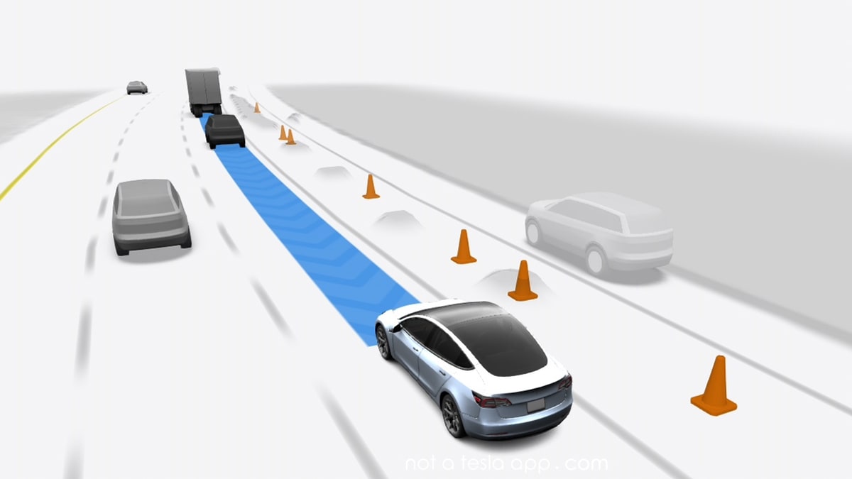
Very good job parking. It looked uncertain when oncoming cars approached. At 5:00 it stubbornly drove head on to the oncoming car. Gotta wonder if that was one-trick-pony SW.
We have learned through a trusted source that FSD v12 has started rolling out internally with Tesla update 2023.38.10.
FSD v12 is the update that is expected to remove "beta" from the title. The initial rollout to employees appears more limited in scale than previous updates. Considering the magnitude of the changes in this version, it makes sense to start slow.
 www.notateslaapp.com

Right. Impressive, especially backing, but it feels set up. It passed a couple of open parking spaces before choosing what it did.Gotta wonder if that was one-trick-pony SW.
I can't find the video now, but I remember watching another Chinese system years ago with advanced auto park and the car is driven in the parking lot to map it out. I don't remember however if it is manually driven during this step or if the car does it automatically. It is not pre-mapped in the sense of the car company going there with a different car and mapping the lot.Right. Impressive, especially backing, but it feels set up. It passed a couple of open parking spaces before choosing what it did.
So many questions - was the garage pre-mapped or did it read signs? Why did it leave in a different direction that it came from? Does it understand handicapped/reserved parking signs? What does it do if it cannot find a spot?
NIO has similar feature; you drive once for it to map and learn the parking lot then it can park by itself in that same parking spot every time when you pull into the entrance, but you can't summon it to come back to your location, the Huawei feature is more advanced and seems to be a true valet parking feature that parks itself and comes back when you need it to.I can't find the video now, but I remember watching another Chinese system years ago with advanced auto park and the car is driven in the parking lot to map it out. I don't remember however if it is manually driven during this step or if the car does it automatically. It is not pre-mapped in the sense of the car company going there with a different car and mapping the lot.
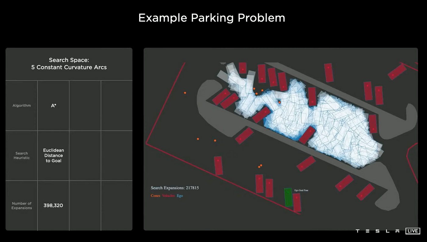
That's not the same thing. They are discussing about Monte carlo search tree algorithm for path finding. The simulated environment is a parking lot.Tesla did a similar demo in the past for AI Day back in 2021 for mapping out a parking lot's spaces:

As we can see from the map, Mobileye has mapped the majority of US roads in just 10 months.
Slight correction: they've said they've mapped "the majority of the US" not "the majority of US roads." Big distinction, especially on such a small map with relatively thick lines representing the roads.
I'm interpreting "majority of the US" to mean they have mapped roads in at least 51% of the areas of the US. The CIA World Factbook estimates there are over 6.5 million km of roads in the US. I don't think Mobileye is claiming to have mapped over 3.2 million km.
Video segment of Europe and the USA with those map from 1 day to 10 months here:As we can see from the map, Mobileye has mapped the majority of US roads in just 10 months.
Do you have the link for this? Hard to tell from this map but some of the gaps appear to be in relatively populated areas.As we can see from the map, Mobileye has mapped the majority of US roads in just 10 months.
Video segment of Europe and the USA with those map from 1 day to 10 months here:
16:50 minutes in
Video from this page: The Road to the Future of Mobility is Being Mapped by REM™ | Mobileye Blog
Point well taken. Thanks. From the map, it looked like most roads are mapped, especially on the east coast. But you are right that the lines are thick and might not be showing every road. And, a lot of the north west part of the US is mostly empty so there are not a lot of roads there anyway.
I am still impressed that they have mapped as much as they have in only 10 months.
Do you have the link for this? Hard to tell from this map but some of the gaps appear to be in relatively populated areas.
For an individual, it doesn't matter much if Mobileye has mapped all of the highways through their state; they need to have mapped the exits and local roads in order for a useful robotaxi to actually take them from any one address in their area to another.
We're one big step closer to rider-only operations! The latest updates to our MPDM system pave the way with improved metrics related to rider comfort, faster routing, better trip efficiency and more. #FutureIsNow https://bit.ly/46uihLt
