Welcome to Tesla Motors Club
Discuss Tesla's Model S, Model 3, Model X, Model Y, Cybertruck, Roadster and More.
Register

Tesla Software updates - Australia

This site may earn commission on affiliate links.
I am Still on 2023.x and last week wish I'd had this update then. Heading home from Port Melbourne to Greensborough the plan was on westage fwy at Montague St, over Bolte Bridge and home in about 45 mins.
Instead, not being used to these roads at all, I got in the wrong left turning lane at Montague St (middle one instead of behind all the trucks in the far left lane). So instead of heading for the Bolte Bridge I cursed to find myself stuck on the ramps to the Westgate Bridge and no way off. So OK, I'll go ring road home maybe 1h. Well then the traffic stopped (mid afternoon weekday) at the foot of the Westgate bridge. Mega roadworks I was completely unaware of. Took 30 mins to get past Millers Road, temperature rising, AND THEN following the Tesla Nav I stayed left and found myself heading for Geelong not the ring road. Aaaarrrgghhh. Took another 15 mins to reach Altona turnoff and do a uturn over the freeway before finally reaching the ring road after just under an hour and home in about 1h40. My original mistake magnified many times over, felt like punishment by the Auto Gods.
I feel for you.

This is why it is so important.

If Tesla offered Apple/Android integration, then they wouldn't have to worry about mapping because someone else is doing it. They've chosen to do their own nav (although they're not - they're just outsourcing it to another crap mob that isn't Android/Apple), so they need to get it right.

End goal "Full Self Driving"?

Unfortunately, they can't even get NoA right on Freeways. I gave them credit for finally sorting that one particular exit over 12+ months late, but they still can't get the number of lanes right on other parts of the ring road which results in NoA lane changing fails. For example, between the Tulla and the Calder on the Ring Road westbound, Tesla always thinks there is one more lane than there actually is - if there are 4 lanes, the Tesla shows 5 lanes on the Nav, and always wants to go one lane further to the right than it should.

It has cameras. It should be able to see those lanes, and feed that data back. Tesla should be able to create better maps based on the data that it's own fleet is actually generating - there are plenty of Teslas out there generating data, they don't have to pay someone else to map it! They are obviously not doing that, it seems they are just buying crap mapping from the cheapest tenderer.
 
because someone else is doing it.
Someone else is - Google!

Have you checked what Google says on you mobile or another car using Google for mapping/nav?

Its not the platform it runs on (Android, Apple, Tesla) its the service being provided.

...and yes, you can get a different answer from Google depending on the platform you are one... that one I have no idea why - Google on iPhone compared to Google on web browser (Safari) can give different directions!
 
As of 2024.2.2.1, I've noticed that as I approach the car, it seems to know I'm approaching and 'turns on' ie. I hear the 'thunk' sound of the high voltage contactors engaging. I've observed it twice and in both cases the car was left over night, 'off', not charging and I hadn't interacted with the app before approaching.

Anyone else notice this or just coincidence that it happened to wake?
 
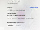
Since the recent update (see image below), I've noticed that the air conditioning doesn't cut in for some time to cool the car after commencing driving. The other annoying thing is that the colours displayed on Google Maps are now quite bizarrely vivid and the resolution of the maps appears to be considerably less than what it was. Anyone else? I'm on Sunshine Coast QLD.
 

Attachments

  • IMG_1176.jpg
    IMG_1176.jpg
    2.6 MB · Views: 18
Last edited:
The satellite imagery is from Google Maps, possible the area you're in has received a new set of tiles. It's downloaded OTA though, so not part of a software update. I'm about to head bush for a few days on 2024.2.3, and noticed that some of the NRMA chargers are missing from the third party chargers list, notably Gunnedah, Narrabri, and Coonabarabran aren't on my list, not even if I select destination charger grade power limits.
 
The satellite imagery is from Google Maps, possible the area you're in has received a new set of tiles. It's downloaded OTA though, so not part of a software update.
Yes the tiles are completely different from a week ago and it's definitely NOT an improvement (aesthetically at least). Some areas (around Noosa) are as before, pleasing colour rendition and high definition, but you can see the (ghastly) change to garish colours and seemingly lower resolution in many areas where the maps join.

I knew they were Google maps although I thought the map images came through as part of Tesla's GPS upgrade.
 
Last edited:
I knew they were Google maps although I thought the map images came through as part of Tesla's GPS upgrade.
I don't think it's reasonable to store all the aerial view images in the car, it'd take far too much space - so they have to be downloaded as you need them, and the additional bandwidth that requires is why it requires premium connectivity for that feature.
 
  • Like
Reactions: Jules22
The satellite imagery is from Google Maps, possible the area you're in has received a new set of tiles. It's downloaded OTA though, so not part of a software update. I'm about to head bush for a few days on 2024.2.3, and noticed that some of the NRMA chargers are missing from the third party chargers list, notably Gunnedah, Narrabri, and Coonabarabran aren't on my list, not even if I select destination charger grade power limits.
They probably fail the used by Tesla drivers at least once every 4 days over a 60 day period test.
 
I had a quick look at Plugshare for Narrabri and from my casual look, it does not look as if there have been enough Tesla sessions. Of course, not everyone puts their sessions into PlugShare. Still, it's a plausible explanation.

Of course, if not in the Nav they may be less likely to be used which might make them less likely to be in the Nav..................Chicken and Egg situation
 
The full Google Maps satellite imagery at full resolution is several hundred TB in size - with 3D imagery going into the Peta bytes (>1000 TB). So even the "standard" satellite imagery we get in our cars are with 100% guarantee not part of our software update downloads.
 
  • Like
Reactions: Jules22
I had a quick look at Plugshare for Narrabri and from my casual look, it does not look as if there have been enough Tesla sessions. Of course, not everyone puts their sessions into PlugShare. Still, it's a plausible explanation.

Of course, if not in the Nav they may be less likely to be used which might make them less likely to be in the Nav..................Chicken and Egg situation
Are you saying Tesla uses plugshare as third party charger datasource?

edit: I think I know what you're getting at. You're suggesting Tesla uses charging sessions as the metric of which chargers to add?
 
Last edited:
  • Like
Reactions: doggy1
Unfortunately, they can't even get NoA right on Freeways. I gave them credit for finally sorting that one particular exit over 12+ months late, but they still can't get the number of lanes right on other parts of the ring road which results in NoA lane changing fails. For example, between the Tulla and the Calder on the Ring Road westbound, Tesla always thinks there is one more lane than there actually is - if there are 4 lanes, the Tesla shows 5 lanes on the Nav, and always wants to go one lane further to the right than it should.
I did manage to drive through Princes Freeway -> M80 -> Tulla on NoA without any interventions (except initiated Auto lane change) !! It took all the exits and merged in beautifully. Didn't think to try the reverse though. Earlier versions of NoA used to try to kill me every time by changing its mind at the last minute while taking exits. But I get your point - Today, while joining Calder from DFO Essendon, it indicated wildly left and right, but didn't do anything stupid.
 
It does, read the link I posted above.
Are you saying Tesla uses plugshare as third party charger datasource?

My query relates to Plugshare. Is that where Tesla gets the charging data? In Europe I thought third party providers (who wanted to be included in Tesla Nav) had to regularly log the data to Tesla as part of their submissions to be included in Tesla Nav. Is that how it works? Would NRMA and others have submitted their details to Tesla and ongoing send reliability and charging data? Or do our cars send info each time we charge at a third party charger and log usage and success/failure?
 
Call me a Luddite but why would Google maps' (so called) upgrade to inferior maps for 2024? Insane!
What I got from this is that Google might be upgrading some of their satellite maps, so far in my area they have not done that for over a decade. When I look at my house on Google maps, I had solar installed on the roof 8 years ago, but map images still dont have solar. There are also multipole buildings that have been built in that time and some that have been torn down and none of it has been in google maps satellite images.
So I went to google maps web this morning and it appears to be updated for my area. The colors and resolution is way worse than before, but at least it has solar panels on my roof now. From the looks of it the image is still more than 6 months old as I had the roof pressure washed then and this roof looks as dirty as neighbours. Also street view is more than few years old (at least 4-5 years old).
 
Our street view is from 2016 when someone dumped some crap out the front of our house :)
Next door is from 2018 and 2 doors up is from 2019. So no idea how they do it. Apple satellite are a lot more up to date.
With Maps I just like them to update them more often. We have a bit of road work around us with the NE link crap and routing is not up to date.