I had did some research into this a couple years back. Here were some note I gathered. Parse it as you will.
------------------------------------------------- ------------------------------------------------- ------------------------------------------------- -------------------------------------------------
Maps:
- “Console” Display – S/X (3?) – Main Computer Unit (MCU/1/2)
- The S/X 17” display showing Google visual display map tiles are via on-board (CID SSD) navigation maps.
- The Autopilot also has ADAS (adv driver assist sys) map tiles that are fetched from a server (<geohash>.tile). Each tile covers a certain fixed geographic area [5 char geohash], and they contain information that the AutoPilot uses for assisting it's decision making (i.e. extra info besides cameras for slowing for turns as an obvious one).
- Just like the Google visual map tiles, a certain amount of them are cached on the CID's SSD so the ones around your daily routes don't need to be downloaded over and over.
- Changed to vector based maps.
Great video showing before/after: Article with picts: Tesla's new 'light-years ahead' navigation and maps engine is 'almost done', says Elon Musk
Side by side video:
- “Drivers” Display – S/X - CID Center Instrument Display (aka IC Info Cluster)
- NAV 1.0 - Navigation is from Garmin/Navigon
- NAV 2.0 - appears to have two options for routing. When "online routing" (Tesla navigation via Valhalla?) is enabled and there's a connection, the routing request is sent to a cloud server which should be using up-to-date information to do the routing. If "online routing" is disabled or there isn't a connection, the routing will be done onboard using the offline onboard information - which will provide a route, though will likely not be as accurate because the onboard database will likely be 1 to 2 years out-of-date (depending upon how often Tesla distributes updates - slow release from Garmin/Navigon?!?).
- Offline TomTom speed limit database
- There is some question on OpenStreetMap usage (via MapBox and Valhalla) being used in other countries currently. There are some places where Google/other satellite navigation info is not allowed/prevalent so Tesla has to have other options? - read Tesla Turns To Open Sourcing For Updates To Mapping Platform
AutoPilot ADAS Map Tiles
- Tile map view over and v1 of software (requires .NET Framework 4) : Tesla Autopilot maps
- V2 of software: Tesla Autopilot maps (I think several great things in his updates but I think one of the coolest and useful features is background maps!! -- Menu: View-> Background -> Hybrid)
- My research on tools to use: Tesla Autopilot maps
- Download the 5 char geohash in the /live/ URL (i.e. replace c25qb): https://daws.tesla.services/iiNG2d6xFR1USl/live/c25qb.tile
MapBox which uses OpenStreetMap in Taiwan?
[source:
]
The maps are from Google, but the navigation is from Garmin/Navigon.
UPDATEs: EVRider | August 30, 2019
@TeslaTap: Tesla was using Garmin Navigon until June 2017, then switched to Tom Tom. Now they use a proprietary system based on open source Mapbox and Valhalla. Here’s my source:
Whose mapping service do Tesla cars use for its in-car navigation system? Has it always been the same? Who is the latest?
Whose mapping service do Tesla cars use for its in-car navigation system? Has it always been the same? Who is the latest?
Hagrinas Mivali, Tesla owner -- Answered Oct 8, 2018 · Upvoted by Christopher John Anderson, Quality Technician at Tesla (2018-present)
Tesla has gone through several sources. Originally they used Navigon for map data. They displayed (and still do) a Google Maps overlay in the center console of the Model S and Model X. But the cars need to have local map data in order for navigation to work when there’s no data connection.
Having two sources was never ideal because there can be times when Google maps is more up to date than what’s in the car. So there might be times when a route shown on the center screen seems strange, because there’s a road that’s clearly there but the navigator doesn’t want to take it. When that has happened to me in the past, map updates (which come about once a year) caused better routing over time.
Around June 2017, Tesla reportedly switched to TomTom for the internal maps, and continued with Google for the maps on the center screen.
When the Model 3 came out, there was no secondary map displayed. The Google map is the only one visible, but the car still uses its own local map data.
The most recent Tesla navigation system is proprietary, and reportedly was built using open source software from Mapbox and Valhalla. The overlay map is still from Google, and especially on cars with just one screen, it gives the impression to some people that the navigation is from Google. But it never was.
In past years, Google often gave much better routes, especially in areas with heavy traffic and alternate routes, and a person who tried using a smartphone and the car for navigation at the same time could see a big difference. The latest software will give a route that’s likely to be closer to what Google gives. In some cases, it will be much better because Tesla’s navigator now supports HOV lanes, and in many areas, EVs can operate in HOV lanes with fewer passengers.
-------------------------------------------------
The map updates are for the navigation maps on the dash. The map on the 17" screen is from google maps. It's interesting to see how they don't match up when you are on newer roads.
Map updates early 2016 (Jan/Feb)
2014 Aug -- OFFICIAL: Onboard map updates coming with 6.0 -- Submitted by nickjhowe on August 21, 2014
For those that aren't aware of the details, the 17" display shows Google Maps via the 3G connection, but the navigation system (requires the Tech Package) uses onboard maps (ensuring navigation when there is no cell coverage). Tesla promises "7 years of free map updates", but so far no-one seems to have received any updates.
I've just managed to get an answer directly from Jerome (text in italics), so I think we can take this as gospel:
Dear Mr. Howe:
Thank you for your message and bringing this question to my attention.
With the upcoming release of 6.0, we will begin rolling out new on-board navigation maps to customers automatically over Wi-Fi. As long as the user has set up home or work wi-fi, there's nothing else the user will need to do. We currently expect 6.0 to start to roll out in a matter of weeks.
The feature is coming up – soon. We are committed to continue improving the Model S!
Many thanks for your continued support and your patience! Best regards,
So you are talking about the routing overlay, which is Garmin BTW, not the actual maps.
-------------------------------------------------
Garmin/Tesla/Google navigation package
A major reason for not distributing frequent updates to the Navigon/Garmin navigation map database is because the download is very large - the entire map database is downloaded and installed approximately once per year (though I can't recall seeing any updates since Q4 2015).
Almost all of that map database will never be used - because it contains detailed map data for areas where the cars will never be driven. Only the region around where the car is located - and where a car will be heading on a road trip are needed. Which leaves almost all of the database that is not being used - and really doesn't need to be updated.
The Google map data is up-to-date because it isn't being cached in the car. (false; is cached per highly respected tech: Ingineer)
bob_p, Apr 20, 2018 Tracking the new maps rollout
NAV 1.0 is using an offline Navigon/Garmin map database (which appears to be over 2 years old in the US), offline TomTom speed limit database (which has many inaccurate and missing speed limits, though there are reports the speed limit database may have been updated recently), online real-time traffic data (which may be coming from Google), and the online Google maps/satellite display for use only on the console display. For routing, the Navigon/Garmin "black box" routing software used only the offline map database, offline speed limit database, and online real-time traffic data for routing.
_ NAV 2.0 appears to have two options for routing. When "online routing" is enabled and there's a connection, the routing request is sent to a cloud server which should be using up-to-date information to do the routing. If "online routing" is disabled or there isn't a connection, the routing will be done onboard using the offline onboard information - which will provide a route, though will likely not be as accurate because the onboard database will likely be 1 to 2 years out-of-date (depending upon how often Tesla distributes updates).
_ To achieve EAP/FSD goals, NAV 2.0's online routing will be critical - so the software knows the current location of highway entry/exit ramps and the current location/status of streets & intersections. This will never be achievable using an offline database, because it will be impractical for Tesla to keep every car up-to-date with the most recent maps.
_ Though... If they were much smarter in the management of the onboard data, they could keep the onboard information up to date. We actually use only a very small amount of the map data each day - usually only an area within a 50 to 100 mile radius of where the car is parked overnight. Tesla could implement an incremental update system that would send only the changed information within this area to each car overnight - and when your car needed information outside of that area, it could request a download of the additional slice of data - which would still be relatively small compared to the maps for an entire region (like the US or North America)...
-------------------------------------------------
old Navigon mapping engine - which is the one being replaced by Tesla navigation.
_ Also, when trying to predict what features Tesla will implement with their nav system, you need to keep in mind that every feature they add or improvement they make is done to make possible FSD. Waypoints, multiple routes, etc. are all great features for someone who is driving their own car. For FSD, the nav system itself will make those decisions, so there is no reason to open those options up to the end user.
_ For good or bad, we drivers are not Tesla's priority, FSD is.
verygreen, Nov 10, 2017 --
Tesla Autopilot maps
_ Many of you have noticed already that the car seems to slow down in TACC and autosteer mode before curves. So I was researching how is speed limit determined (some people I asked were sure it was from Navigon maps, but I think evidence does not support it).
_ Anyway lo and behold I found that there are "adas map tiles" thing the car pulls calculated on current coordinates. I am not really sure what is the format, but it at the very least contains various curvatures of the roads (used to calculate safe speeds for curves), but also is consisting of "branches". Branches have various properties like what road class is it, whenever the next branch exit is an offramp (to the left and right too), if the branch is itself a ramp, should autosteer be enabled, should autopark be restricted, is it a two way traffic branch, should "pedal misapplication mitigation" (?) be enabled, should radar braking be enabled, side collision assist enabled, length of this branch in meters, speed limit, speed limit units and some more cryptic stuff.
_ It looks like there's also some code to feed some curve and other data back to mothership, but it's not clear if it needs to be separately enabled. Additionally there are multiple levels of this tile data - development, live, staging and staging2, Korea gets its own tiles for some reason.
-------------------------------------------------
Ingineer, Jul 29, 2016 --
Firmware 7.1 (AP1.0 on v7.1)
Just like the little square image tiles on Google maps, the Autopilot also has tiles that are fetched from a server. Each tile covers a certain fixed geographic area, and they contain information that the AutoPilot uses for assisting it's decision making. Just like the map tiles, a certain amount of them are cached on the CID's SSD so the ones around your daily routes don't need to be downloaded over and over.
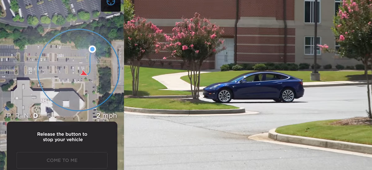
Tesla will build its own maps using driving data from the fleet, confirms Elon Musk -- Posted on 13 Apr 2020
Elon Musk just confirmed that the Smart Summon feature will use data points to navigate in a parking lot using the data and maps generated by the fleet.

www.xautoworld.com
In 2018, MapBox acquired a routing engine named 'Valhalla', which is now part of the core API MapBox provides to users and enterprise clients like Tesla, Facebook, and many more. MapBox claims they gather data from millions of devices that their application is a part of and they reach at least 600 million people a month.
“The company started updating its maps and navigation systems using MapBox and Valhalla.
Several sources confirmed to Electrek that with its most recent updates, Tesla has started pushing new modules from MapBox, an open source mapping platform for custom designed maps, and Valhalla, an open source routing engine for navigation, in its fleet.
The new services are being deployed in Taiwan first, where the company had yet to enable its in-car navigation app, but the new modules are in all vehicles and could technically be enabled by Tesla in its other markets.”
Also via:
Tesla is updating its maps and navigation with open source mapping platforms
-------------------------------------------------
verygreen, Jan 4, 2021 at 10:37 PM
These (downloaded tile) maps are abandoned, Tesla now uses straight out openstreetmaps dumps with their own data added where needed. you can get a copy of their valhalla from their github repo.
Via:
Tesla Autopilot maps