Welcome to Tesla Motors Club
Discuss Tesla's Model S, Model 3, Model X, Model Y, Cybertruck, Roadster and More.
Register

Wiki Superchargers Visited

This site may earn commission on affiliate links.
**** NOTE: We have transitioned to a new platform ****
More Info: Supercharging.Life database

This is a friendly contest for Tesla owners to track the number of unique public Superchargers where they have charged

- "Supercharger count" is the number of unique public Superchargers where you have charged (just being there does not count), whether or not you were the person plugging in the vehicle (such as a Valet Parking garage or a Passenger) and whether or not it was your own personal vehicle (such as a rental, a loaner, or a friend's Tesla) as long as you were the one who drove >50% of the distance to reach the charger(s).
- The list of chargers in the supercharging.life database are the ones included in the game. If you think one should be added or removed from the list, let us know.
- Only chargers available to the public without special permission are included in the game.
- Chargers not connected to the grid are not counted.
- Doublet locations like the North/South Supercharger 'pairs' in CT, ME, NH, etc. count as individual locations.
- More than 1 charger at the same address, such as Lenox Square Mall (Atlanta, GA) or Montgomery Mall (Bethesda, MD) count as individual locations when they appear as a separate location on the Tesla Nav screen.
- Inactive competitors will be archived and removed from the leaderboard. Just post an update to be reactivated.

See Supercharging.Life database for info on how to post your own visits to the database (preferred), or post your locations with date visited to this thread and one of the admins will update your list for you. All visits must be posted to this thread - not just entered in supercharging.life. If you are the first in the game to visit a supercharger location, please post to the thread as soon as you can so others know it has been visited.
 
Last edited by a moderator:
Monarch Pass is a lot more fun to drive than I-70. But if you want a really scenic and fun drive, try US 550 over Red Mountain Pass from Durango to Ouray. The section from Silverton to Ouray is known as the "Million Dollar Highway."

Of course I am biased because little Ouray County, population 5000, has been my home for several decades!

US 50 may be open again by July. Check before you head to Utah.
Keep the road suggestions coming across the West. I expect these wonderful roads will comprise a big part of my route planning from late May through late July.
Oh, dang, I was just there, but decided to take the route down from Mountain Village (Telluride) thru Cortez to Durango as it didn't require any backtracking. If I had only known the other road would be prettier. Looks like it runs along the peak of the mountains too, very much like the Top of the World route northeast of LA near Lake Arrowhead
^ Lizard Head Pass is pretty scenic from Ridgway over Dallas Divide (State Highway 62) to Mountain Village (SH 145) and the Pass. From the Pass to Cortez it is ok — nice drive through the mountains but nothing special by Colorado standards.

The Million Dollar Highway over Red Mountain Pass, 11,018 feet (3358 meters), is one of the most scenic in Colorado. (We had our wedding pictures taken at the Bear Creek Falls overlook earlier this month.) Be aware that the road is narrow and curvy in spots (10 mph and 15 mph curves) with no shoulders or guard rails (so that avalanches can flow over the road and the snow pushed off into the gorge in winter). Those afraid of heights might be uncomfortable.

Other scenic drives in Colorado include:

• Trail Ridge Road through Rocky Mountain National Park, (12,183 feet in elevation, US 34, open summers only),
• Independence Pass from Aspen to Leadville, (12,095 feet, State Highway 82 to US 24, open summers only).
• I mentioned upthread the drive over Grand Mesa, from Delta and Cedaredge to I-70 via State Highway 65. A scenic way to get from Montrose Supercharger Station to Parachute Supercharger Station.
• The drive though Colorado National Monument is well worth doing; it is easily accessible from Grand Junction Supercharger Station or the Fruita exit off I-70.

Much more obscure, except to locals, is the loop from Ridgway over Dallas Divide to Gateway to Whitewater, SH 62 to SH 145, SH 141, then US 50 back to Montrose or north to Grand Junction. The Gateway Canyons Resort has a couple of Tesla destination chargers across from the entrance to an excellent auto museum. There are also some lovely hiking/mountain bike trails on BLM land adjacent to the resort that I helped build years ago with Volunteers for Outdoor Colorado (I'll attach a pdf of the trail map). The section from Uravan to Gateway is red rocks canyon country, much like adjacent southeastern Utah. The section from Gateway to Whitewater is also canyons but of completely different geology. This route can also be used to get to Moab the peaceful, scenic way by turning on SH 90 just north of Naturita.

While I'm at it, I'll put in a plug for my local National Park: Black Canyon of the Gunnison NP. The road to the south rim is about eight miles east of the Montrose Supercharger Station.

There are, of course, many other scenic drives around here and I expect that other Coloradans will have their favorites.

Pictures. I'll use thumbnails so I don't clutter up the thread too much.

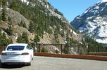
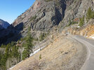
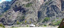
Some views of US 550 south of Ouray:

Model S and US 550 Million Dollar Hwy1618cropsf 3-19-16.jpg
^ A look at highway 550 from Bear Creek Falls overlook in 2016.

US 550 Million Dollar Hwy1621edsf 3-19-16.jpg
Model S on US550 2292-93sf 6-24-19.jpg
^ A couple of pictures from places wide enough to pull over and park.

On the road to Independence Pass2117-19sf 9-14-18.JPG
^ A curve in the road to Independence Pass, SH 82. A bit of this road is so narrow that cars need to take turns. Long or wide vehicles are banned.

Dolores River Canyon2150sf 10-20-18.jpg
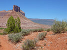
^ On the road to Gateway along the Dolores River, State Highway 141.

The Palisade at Gateway1883sf 4-22-17.jpg
The Palisade at Gateway, from a trail.

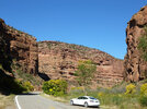
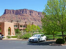
Charging at Gateway1880sf 4-22-17.jpg
^ Charging at Gateway Canyons Resort. The Tesla destination charge stations are free to use for anyone, last I was there.


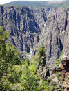
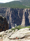
Black Canyon Gunnison Point1368-69sf 6-2-15.jpg
^ Black Canyon of the Gunnison. Very hard to photograph but quite impressive in person At one point the canyon is less than a thousand feet across at the top but more than 1800 feet deep. So, quite steep!

Claret Cup at Black Canyon2458sf 6-3-21.jpg
^ Claret cup cactus in bloom at Black Canyon, 3 June 2021 (bottom of picture). The rim elevation is about 8000 feet. (Yes, we have cactus in the Colorado mountains.)
 
The Million Dollar Highway over Red Mountain Pass, 11,018 feet (3358 meters), is one of the most scenic in Colorado. (We had our wedding pictures taken at the Bear Creek Falls overlook earlier this month.) Be aware that the road is narrow and curvy in spots (10 mph and 15 mph curves) with no shoulders or guard rails (so that avalanches can flow over the road and the snow pushed off into the gorge in winter). Those afraid of heights might be uncomfortable.
It wasn't 11,000 feet, but the road sounds a lot like the one we drove going into Yosemite many years ago.
 
^ Lizard Head Pass is pretty scenic from Ridgway over Dallas Divide (State Highway 62) to Mountain Village (SH 145) and the Pass. From the Pass to Cortez it is ok — nice drive through the mountains but nothing special by Colorado standards.

The Million Dollar Highway over Red Mountain Pass, 11,018 feet (3358 meters), is one of the most scenic in Colorado. (We had our wedding pictures taken at the Bear Creek Falls overlook earlier this month.) Be aware that the road is narrow and curvy in spots (10 mph and 15 mph curves) with no shoulders or guard rails (so that avalanches can flow over the road and the snow pushed off into the gorge in winter). Those afraid of heights might be uncomfortable.

Other scenic drives in Colorado include:

• Trail Ridge Road through Rocky Mountain National Park, (12,183 feet in elevation, US 34, open summers only),
• Independence Pass from Aspen to Leadville, (12,095 feet, State Highway 82 to US 24, open summers only).
• I mentioned upthread the drive over Grand Mesa, from Delta and Cedaredge to I-70 via State Highway 65. A scenic way to get from Montrose Supercharger Station to Parachute Supercharger Station.
• The drive though Colorado National Monument is well worth doing; it is easily accessible from Grand Junction Supercharger Station or the Fruita exit off I-70.

Much more obscure, except to locals, is the loop from Ridgway over Dallas Divide to Gateway to Whitewater, SH 62 to SH 145, SH 141, then US 50 back to Montrose or north to Grand Junction. The Gateway Canyons Resort has a couple of Tesla destination chargers across from the entrance to an excellent auto museum. There are also some lovely hiking/mountain bike trails on BLM land adjacent to the resort that I helped build years ago with Volunteers for Outdoor Colorado (I'll attach a pdf of the trail map). The section from Uravan to Gateway is red rocks canyon country, much like adjacent southeastern Utah. The section from Gateway to Whitewater is also canyons but of completely different geology. This route can also be used to get to Moab the peaceful, scenic way by turning on SH 90 just north of Naturita.

While I'm at it, I'll put in a plug for my local National Park: Black Canyon of the Gunnison NP. The road to the south rim is about eight miles east of the Montrose Supercharger Station.

There are, of course, many other scenic drives around here and I expect that other Coloradans will have their favorites.

Pictures. I'll use thumbnails so I don't clutter up the thread too much.

Some views of US 550 south of Ouray:

View attachment 1042647
^ A look at highway 550 from Bear Creek Falls overlook in 2016.

View attachment 1042646
View attachment 1042645
^ A couple of pictures from places wide enough to pull over and park.

View attachment 1042649
^ A curve in the road to Independence Pass, SH 82. A bit of this road is so narrow that cars need to take turns. Long or wide vehicles are banned.

View attachment 1042650
^ On the road to Gateway along the Dolores River, State Highway 141.

View attachment 1042651
The Palisade at Gateway, from a trail.

View attachment 1042654
^ Charging at Gateway Canyons Resort. The Tesla destination charge stations are free to use for anyone, last I was there.


View attachment 1042664
^ Black Canyon of the Gunnison. Very hard to photograph but quite impressive in person At one point the canyon is less than a thousand feet across at the top but more than 1800 feet deep. So, quite steep!

View attachment 1042666
^ Claret cup cactus in bloom at Black Canyon, 3 June 2021 (bottom of picture). The rim elevation is about 8000 feet. (Yes, we have cactus in the Colorado mountains.)
This is great. I've been adding roads to a personal Google Maps. I just went through my locations and put them in a new and public map. I've used your notes above to highlight why some of these roads should be driven. There are so many more cool roads out there. Let's keep adding them.

You can find it here: Google Maps

That is a view only link. If you'd like to help me add other great roads for us to drive, let me know and I'll share a link via PM that allows you to edit the map.

1714345374593.png
 
Check-ins for 2024-04-28
- Frederick - Ballenger Creek Pike, MD (#2948)
- Owings Mills, MD (#2949)
- Arbutus, MD (#2950)
- Aberdeen - N Philadelphia Blvd, MD (#2951)
- Port Deposit, MD (#2952)
- Wilmington - Limestone Rd, DE (#2953)
- Dover - Forrest Ave, DE (#2954)
- New Castle - Airport Rd, DE (#2955)
- Carneys Point, NJ (#2956)
- Exton, PA (#2957)
- Morgantown, PA (#2958)
- Quakertown, PA (#2959)
- Yardley, PA (#2960)
- Manahawkin, NJ (#2961) (First to check-in)

Check-ins for 2024-04-29
- Clark, NJ (#2962)
- Brooklyn, NY (#2963)
- Jericho, NY (#2964)
- Yonkers - Central Park Ave, NY (#2965)


This was a bit of a hero run trying to get past NYC so I didn't have to drive through on a Monday. Didn't quite make it as far as I would have liked, but I think I mostly accomplished my goal as I'm staying in Yonkers now and should have a decent escape route in the afternoon across the Governor Cuomo Bridge.

Apologies for the outrageously rude 11:30pm stealth first in Manahawkin. I totally forgot that this was a first visit until I just noticed it now. Hopefully no one had their heart set on that one.

Some notes... I had a nice meet up with @Thinkje and Lanny at my first stop of the day. There was a horse and buggy parked next to the supercharger in Morgantown, PA but I couldn't really get a good picture. Hit some somewhat unexpected rain just before and after midnight. It was quite heavy at times. Despite showing up at 1:45am on a Monday, I was 8th in line at the Brooklyn supercharger and had to wait 20 minutes to get a stall. Others were trying to avoid the stall that I got because it was only giving 40kW but that was fine with me of course!
 
This is great. I've been adding roads to a personal Google Maps. I just went through my locations and put them in a new and public map. I've used your notes above to highlight why some of these roads should be driven. There are so many more cool roads out there. Let's keep adding them.

...

You may find this series of road trip films interesting to give you ideas. They are all with ICE cars, but they emphasize enjoying the drive and seeing beautiful, and sometimes quirky, things along the way.

At one point, they point out that can relate a little to EV drivers about range anxiety, when they can't find high-octane gasoline in rural Nebraska. 😂


Everyday Driver Road Trip Films
Neat. I've begun going through them and adding them to the map above as appropriate.
 
  • Like
Reactions: juliusa
This is great. I've been adding roads to a personal Google Maps. I just went through my locations and put them in a new and public map. I've used your notes above to highlight why some of these roads should be driven. There are so many more cool roads out there. Let's keep adding them.

You can find it here: Google Maps

That is a view only link. If you'd like to help me add other great roads for us to drive, let me know and I'll share a link via PM that allows you to edit the map.

View attachment 1042730
My sister used to live in Taos and there was a 40 or 50 mile loop north of the city called the Enchanted Circle. I made the mistake of taking it on my normally aspirated vehicle and it was having great difficulty at that altitude, wanna go back and do it in an Electric. Highly recommend adding it to the list.

Also, we have a cabin near Sonora, CA which is hopefully days away from getting it's own SuperCharger, if you visit I recommend that you take the day to exit over the Sonora Pass as that road is some of the most exciting driving I have ever done in the Model 3. Don't go yet, you'll need the range to zoom over the hills and around the curves. I just recharged at the cabin, so I was fine, but I am not letting you charge there. I find the best time to take it is just after dawn, no one is on the road and you can be seriously bad to your tires.

I didn't believe them when they say no big vehicles and I totally overheated my brakes when taking the big Airstream home to the cabin. Could'a died. Managed to stop at this curve and let it cool for the afternoon.

IMG_1620.JPG
IMG_1614.JPG
 
It wasn't 11,000 feet, but the road sounds a lot like the one we drove going into Yosemite many years ago.
That would have been Tioga Pass, elevation 9,945 feet. Head up from US395 at Lee Vining on SR 120 to the park entrance, or enter from the west at Crane Flat and traverse to Tuolumne Meadows before the final ascent.

At the north junction of SR120 and US395 (it duplexes a few miles going south before SR120 heads east to Benton and US6), there is a Mobil gas station and convenience store. Inside the convenience store is the Whoa Nellie! Deli that serves up fabulous food. It is only open during fishing season (late April through Hallowe'en or so). There is usually a line that forms before you can order your selection--it is that popular.

If one opts for grabbing a meal there, I would suggest taking your food to go and then driving into Lee Vining (about ¼ mile north of the junction, then veer off Mattly Avenue to the community park. It is a nice park with restrooms and lots of shade trees and best of all. . . there are two absolutely free J1772 plugs for the using while you enjoy your leisurely lunch or early dinner. The historical society is hard by the park too--worth a little bit of time in my opinion.
 
Neat. I've begun going through them and adding them to the map above as appropriate.
Well then - you should include Arizona 89A between Prescott and Cottonwood. I chased a motorcycle all the way through this section, hanging on the edge of a very large canyon drop-off for about 20 minutes thru 13 miles of hairpin turns (about 5 or 6 miles as the crow flies). Motorcyclist was trying to widen the gap between us, but the Model 3 Performance was in charge of the gap for the entire ride.

Screen Shot 2024-04-29 at 6.41.18 PM.png
 
Arches/Monument Valley Trip - Day 3 (and 2)

Check-ins for 2024-04-29

- Burley - Pomerelle Ave, ID (#2376)
- Salt Lake City - Admiral Byrd Rd, UT (#2377)
- Midvale, UT (#2378)
- South Jordan, UT (#2379)
- Orem, UT (#2380)
- Provo, UT (#2381)
- Nephi - S Main St, UT (#2382)

Image 4-29-24 at 8.19 PM.jpeg
Image 4-29-24 at 8.19 PM (1).jpeg
Image 4-29-24 at 8.20 PM.jpeg


There were no new Superchargers on Day 2, which is why I didn't post, but for completeness, here's the map and stats:

Image 4-29-24 at 8.22 PM.jpeg
Image 4-29-24 at 8.22 PM (1).jpeg
Image 4-29-24 at 8.23 PM.jpeg
 
Check-ins for 2024-04-28
- Laurinburg, NC (#1842)
- Dillon, SC (#1843)
- Lumberton - W 5th St, NC (#1844)
- Durham - Fayetteville Rd, NC (#1845)
- Cary - Tryon Rd, NC (#1846)
- Knightdale, NC (#1847)

Check-ins for 2024-04-29
- Henderson - E Andrews Ave, NC (#1848)
- Franklin, VA (#1849)
- Suffolk, VA (#1850)
- Portsmouth, VA (#1851)
- Norfolk - 1146 N Military Hwy, VA (#1852)
- Virginia Beach - Lynnhaven Pkwy, VA (#1853)
- Stony Creek, VA (#1854)
- Colonial Heights - Conduit Rd, VA (#1855)
- Hopewell, VA (#1856)
- Colonial Heights, VA (#1857)
- Richmond - S Providence Rd, VA (#1858)
- Mechanicsville, VA (#1859)
- Fredericksburg - Jefferson Davis Hwy, VA (#1860)
- Stafford - Eustace Rd, VA (#1861)
- Woodbridge - Daniel Stuart Sq, VA (#1862)
- Springfield - Springfield Mall, VA (#1863)
- Washington - Idaho Ave, DC (#1864)
- Tysons, VA (#1865)
- Reston - Sunset Hills Rd, VA (#1866)
- Leesburg - Compass Creek Pkwy, VA (#1867)
- Frederick - Ballenger Creek Pike, MD (#1868)

Driving through Washington is like driving through a maze. It's the worst.
 
Check-ins for 2024-04-29
- Orangeburg, NY (#2966)
- Mahwah, NJ (#2967)
- Allamuchy, NJ (#2968)
- Mt. Pocono, PA (#2969)
- Trout Run, PA (#2970)
- Kirkwood, NY (#2971)
- Monticello, NY (#2972)

A fairly leisurely day out in the countryside. It always surprises me how sparsely populated this part of the country is relative to the heavily populated areas to the south and east.

Temps got as high as 90F in northern NJ but it doesn't feel like summer at all where I'm staying in Troy, NY. And looking at the forecast, it's going to be downright frigid in New England and Eastern Canada the next few days. I'm gonna have to dust off my jacket!
 
Well then - you should include Arizona 89A between Prescott and Cottonwood. I chased a motorcycle all the way through this section, hanging on the edge of a very large canyon drop-off for about 20 minutes thru 13 miles of hairpin turns (about 5 or 6 miles as the crow flies). Motorcyclist was trying to widen the gap between us, but the Model 3 Performance was in charge of the gap for the entire ride.

View attachment 1042977
Jerome is also a very cool little town. I did that drive in my ICE days.

Also, while we're on the topic of scenic drives in Arizona, I would submit US-60 through Salt River Canyon. And of course Monument Valley or really any of the roads up in that NE part of the state.